REFNow is the mobile app that simplifies and speeds up technical surveying with LiDAR, computer vision e AIdirectly from a smartphone or tablet.
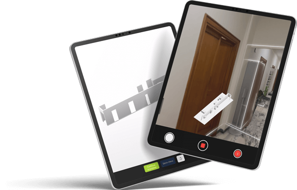
Acquire physical space in real time, generates 3D models, vector plans e mesh high definition, reducing time, errors and rework. Data flows immediately into the ecosystem REFTree for technical management, intervention planning and valorisation.
REFnow is a mobile solution of IdeaRE (Idea Real Estate S.p.A.) for the real-time digital survey of real estate assets. It is designed to digitise field activities, replacing manual processes and unstructured documentation.
It allows the immediate and georeferenced collection of data, integrating them directly into central information systems.
It serves to acquire standardised technical data in the field and support control processes, document updating and operational verification. It reduces errors and data collection time, improving the quality and reliability of information.
It enables a continuous flow between operational activities and digital systems, ensuring real-time updates.
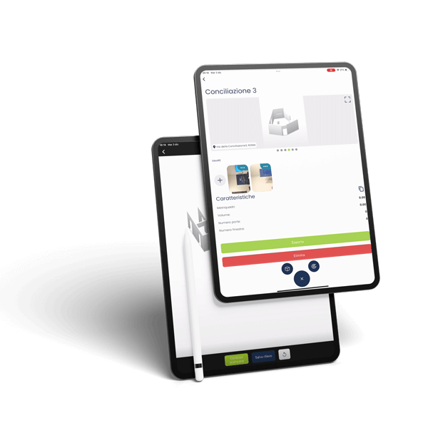
It supports technical census, operational inspections and updating of asset information. It can be used for maintenance checks, status checks and data collection for subsequent analysis.
It facilitates the standardisation of field activities through pre-defined checklists and templates.
It allows traceability of technical data and greater consistency between field surveys and information systems. It improves the reliability of information on which operational and strategic decisions are based. Reduces misalignments between physical reality and digital representation of assets.
It can be used in complex contexts such as multi-asset portfolios, public assets and real estate managed by institutional players. It is suitable for organisations with activities spread across the territory and a need for widespread control.
It supports environments with high frequency of inspections and continuous technical updates.